FPS Geospatial - UAV (DRONE)
Mapping & remote sensing
Latest cutting edge technology with experienced hands on application. FPS Geospatial provide location-based solutions and services to forestry and agriculture industries.
Advances in drone technology have moved aerial imaging beyond merely taking stunning pictures from above. We are now able to harness huge potential with the applications we have for aerial mapping and imaging by extracting and interpreting data in ways previous unimaginable.
Through a Geographical Information System (GIS) we assist organisations visualise, question, analyse and interpret data to recognise patterns and identify trends. This allows you to make data driven decisions with better outcomes.
Aerial Imagery
High resolution geo-corrected aerial images are used for developing orthophoto and orthomosaic maps which are able to visualise every detail on the ground. These “Ortho” maps can be used to measure and analyse different features in the map.
Multispectral Imagery
Multispectral Imagery allows analysis on vegetation health status, growth and weed infestation etc. based on different vegetation indices derived from interpreting light reflectance from the plant. These light frequencies are invisible to the human eye but provide detailed and complex information about the plant.
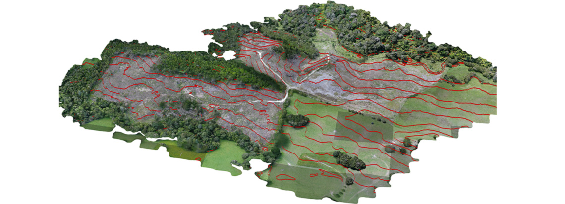
3D Modelling
3D Terrain models are used for visualising land and buildings in 3D, these terrain models are useful for forest management practices such as road and landing construction, silviculture and harvesting and fire control.
Volumetric Analysis
Advanced photogrammetric analysis tools allow us to conduct volume calculations for mine/quarry stock piles, wood chip piles and log stacks in precise and timely manner.
Environmental & Health & Safety Compliance
FPS Geo spatial is providing a range of effective solutions for monitoring environmental and health and safety compliance including safe behaviour observations, erosion monitoring, assessment of harvesting waste, operations near water ways etc.